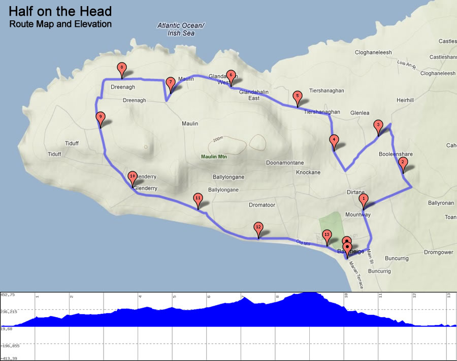
The Half on the Head course map and elevation is outlined below. You can also view a Garmin interactive view of the proposed route. You can also download the GPX File of the route.
The Half on the Head follows a wonderfully scenic course from Ballyheigue Village right around the Kerryhead loop before ending up back at the start point. The 13.1 mile run takes you along one of the most unspoilt portions of the Wild Atlantic Way. Run beside the Shannon Estuary with views across the river mouth to the coast of Clare. Glancing back you will see the rugged Kerry coastline stretching to the town of Ballybunion. You might even catch a glimpse of the fabled Cliffs of Dooneen. Upon rounding the point of Kerryhead you will experience the magnificent panorama of Tralee Bay with Mount Brandon and the Maherees as a backdrop. Further along you have stunning views of the coastline stretching from Ballyheigue beach to Banna and Fenit with Blennerville Windmill in the distance. The first half of the course meanders gradually uphill before levelling out at the point of Kerryhead and then beginning a steeper decent back towards the village. Visit our BLOG for details on how best to tackle the route.
There are three water stations on the Half Marathon Route (at roughly the 3.5 mile, 7 mile and 10 mile markers). There are two toilet stops (At the two schools by the 2 mile and 10 miles markers).
The 10K route follows the first 5k of the Half Marathon route. Just after the water stop It makes its way back towards Kerryhead before a descent to the cliff road and a run alongside the sea to the finish. View our 10k Route Map
Check out our Mile by Mile Story Map of the Route View Story Map